|
|
|
|
|
|
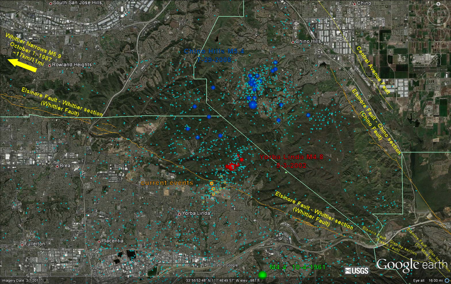
| Yorba LInda Area Quake History |
Just made a map of quake history in the Yorba Linda area. Small light blue dots are background seismicity. (SCSN catalog 1932-present) Dark blue dots are the July 29, 2008 M5.4 Chino Hills quake and aftershocks. Red dots are the September 3, 2002 M4.8 Yorba Linda quake and aftershocks. The green dot is an October 4, 1961 M4.4 quake. Orange dots are the current quakes. Brian
Follow Ups: ● Re: Yorba Linda Area Quake History - Skywise 11:56:22 - 8/9/2012 (80059) (0) ● Re: Yorba LInda Area Quake History - Todd 22:25:18 - 8/8/2012 (80057) (1) ● Re: Yorba LInda Area Quake History - Island Chris 05:50:43 - 8/9/2012 (80058) (0) |
|
|
|
|