06-13-2016, 04:38 PM
Over the past few weeks, I have been trying to establish a positional combination between all seismic events above magnitude 5, it's a little to early to go into much detail yet as I am still trialing it. However, the pattern broke after the Luzon, Phillipines quake last Thursday (9th June), been trying to find out why, but it has left me with an observational conundrum which also includes ACE data, and the reason why it's posted here. The following is a series of images which have no correlation to my own recordings but seem to be oddly coincidental to each other. There are 8 images in total, so I may have to do this in two parts.
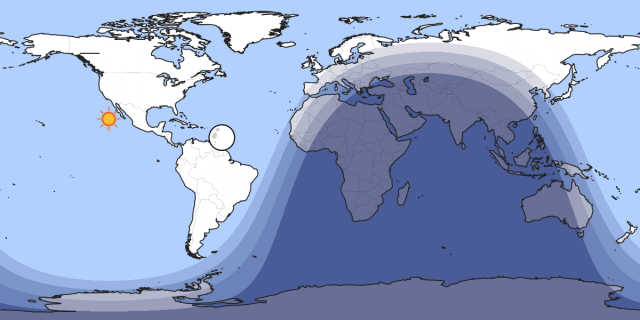
This map relays position of the sun and moon when an m5.3 occurred on Luzon Island, Phillipines at 19:54 ut on 9th June. Nothing significant on this map, it's just the starting point of my lost link ... for those unfarmiliar with the location of Luzon Island, it will soon become apparant in the next images.
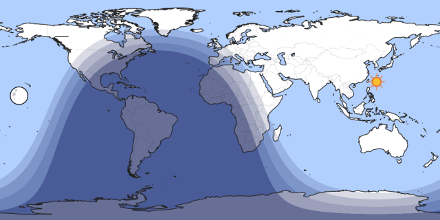
10th June 03:26 ut m6.0 Nicaragua .... Note the sun's position at this time, Luzon Island is below left relative to the maps longitude.
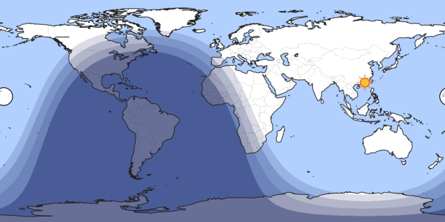
10th June 04:18 ut m6.1 Solomon Islands ... Luzon Island is now below right of the sun !
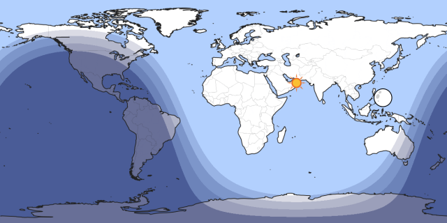
10th June 08:04 ut m5.2 Southern California ... The left limb of the moon is on the same longitude as Luzon Island !!
Up to this point, the earthquakes listed here all occurred in the same sequence shown.
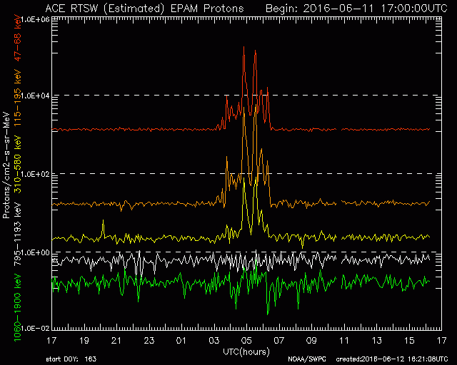
This image was taken from the ACE site on 12th June ... Unfortunately, I missed my chance to recover the 6 hour window version so a little zooming may be nessesary, you can ignore the signal structure, the break in the signal at 10;40 ut is the point of significance here.
Continued in next post ........
This map relays position of the sun and moon when an m5.3 occurred on Luzon Island, Phillipines at 19:54 ut on 9th June. Nothing significant on this map, it's just the starting point of my lost link ... for those unfarmiliar with the location of Luzon Island, it will soon become apparant in the next images.
10th June 03:26 ut m6.0 Nicaragua .... Note the sun's position at this time, Luzon Island is below left relative to the maps longitude.
10th June 04:18 ut m6.1 Solomon Islands ... Luzon Island is now below right of the sun !
10th June 08:04 ut m5.2 Southern California ... The left limb of the moon is on the same longitude as Luzon Island !!
Up to this point, the earthquakes listed here all occurred in the same sequence shown.
This image was taken from the ACE site on 12th June ... Unfortunately, I missed my chance to recover the 6 hour window version so a little zooming may be nessesary, you can ignore the signal structure, the break in the signal at 10;40 ut is the point of significance here.
Continued in next post ........
 Logout
  Portal
  Forum
Forum Search
 Members
 Help
Help 
